Detailed description
To view the map area,
sign in or create account
sign in or create account
25.71 58.87, 28.41 59.62
Identity Description
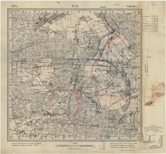
| Title | Eesti topograafiline kaart 1:25000, IV-41, Virumaa |
|---|---|
| Map type | Single sheet map |
| Reference code | ERA.T-6.3.119 sheet 1 |
Notes
Ülesvõtnud 1.juunist kuni 17. oktoobrini leitnant P. Sergejev ja 21. augustist kuni 7. oktoobrini n.-leitnant V. Rosenberg. Joonestanud ltn. P.Sergejev ja n.-leitnant V. Rosenberg
Cartographical and Publishing Description
| Main subject | administrative |
|---|---|
| Material designaton | map |
| Manuscript/Printed | printed |
| Published by | Riigi trükikoda |
| Created | 1927 |
Components and Mathematical Description
| Components | explication, legend for symbols, grid lines, graphical scale |
|---|---|
| Azimuth | Not set |
| Relative scale | 25000 |
Geographical Description
| Admin unit | Specification |
|---|---|
| Estonia (1917-1950) / Viru County |
Physical Description
| Storage form | streched |
|---|---|
| Material and mounting | paper |
| Medium | printed |
| Dimensions (cm) | 55x60/A1 |
| Access-restrictions | No access restriction |