Detailed description
To view the map area,
sign in or create account
sign in or create account
21.79 41.47347, 28.41 82.06518
Identity Description
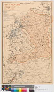
| Title | Eesti ja Põhja-Lääne armeede väeliin 10. ja 25. okt. 1919. a |
|---|---|
| Map type | Single sheet map |
| Reference code | ERA.495.10.28 sheet 5 |
Cartographical and Publishing Description
| Main subject | military |
|---|---|
| Material designaton | map |
| Manuscript/Printed | manuscript original |
| Created | 1919 |
Components and Mathematical Description
| Components | explication, legend for symbols |
|---|---|
| Azimuth | Not set |
| Textual scale | 1 toll = 10 versta |
| Relative scale | Not set |
Geographical Description
| Admin unit | Specification |
|---|---|
| other / Europe Continent / Eastern Europe Region / Russia | |
| Estonia (1917-1950) |
Physical Description
| Storage form | streched |
|---|---|
| Material and mounting | paper |
| Medium | diazography+coloured |
| Dimensions (cm) | 73x46/A1 |
| Access-restrictions | No access restriction |
Maps referring to this map
| Reference code | Manuscript/Printed |
|---|---|
| ERA.495.10.28 sheet 1 | printed |