Detailed description
To view the map area,
sign in or create account
sign in or create account
21.79 57.51, 28.41 59.69
Identity Description
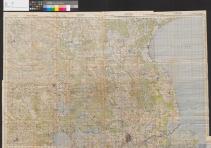
| Title | Saksa vägede dislokatsioon Eesti territooriumil (operatiivkaart 05.08.-02.09.1944) |
|---|---|
| Map type | Single sheet map |
| Reference code | ERA.R-358.2.30 sheet 5 |
Cartographical and Publishing Description
| Main subject | military |
|---|---|
| Material designaton | map |
| Manuscript/Printed | printed |
| Created | 1944 |
Components and Mathematical Description
| Components | legend for symbols, grid lines, compass, graphical scale |
|---|---|
| Azimuth | Not set |
| Textual scale | 1:100000 |
| Relative scale | Not set |
Geographical Description
| Admin unit | Specification |
|---|---|
| Estonia (1917-1950) |
Physical Description
| Storage form | streched |
|---|---|
| Material and mounting | paper |
| Medium | printed |
| Dimensions (cm) | 185x125/4A0 |
| Access-restrictions | No access restriction |