Detailed description
To view the map area,
sign in or create account
sign in or create account
22.07 58.31, 24.73 59.30
Identity Description
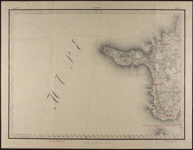
| Title | [Hiiumaa] |
|---|---|
| Map type | Single sheet map |
| Reference code | ERA.2124.1.849 sheet 5 |
Notes
Kaardile kantud maakonnapiir
Cartographical and Publishing Description
| Main subject | administrative |
|---|---|
| Material designaton | map |
| Manuscript/Printed | printed |
| Published by | Sõjaväe Kartograafia Trükk, 1922 |
| Created | 1922 |
Components and Mathematical Description
| Components | legend for symbols, grid lines, graphical scale |
|---|---|
| Azimuth | Not set |
| Relative scale | 126000 |
Geographical Description
| Admin unit | Specification |
|---|---|
| Estonia (1917-1950) / Lääne County | Reigi, Kõpu, Mänspää, Emmaste |
Physical Description
| Storage form | streched |
|---|---|
| Material and mounting | paper |
| Medium | printed+coloured |
| Dimensions (cm) | 51x66/A1 |
| Access-restrictions | No access restriction |
Maps referring to this map
| Reference code | Manuscript/Printed |
|---|---|
| ERA.2124.1.849 sheet 1 | printed |