Detailed description
To view the map area,
sign in or create account
sign in or create account
24.68 59.30, 25.02 59.41
Identity Description
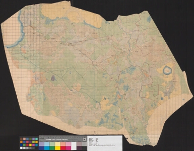
| Title | [Karte von den Gütern Cournal und Rosenhagen] |
|---|---|
| Map type | Single sheet map |
| Reference code | EAA.854.4.790 sheet 1 |
Cartographical and Publishing Description
| Main subject | Not set |
|---|---|
| Material designaton | plan |
| Manuscript/Printed | manuscript rough draft |
| Created | 1873 |
Components and Mathematical Description
| Components | graphical scale |
|---|---|
| Azimuth | Not set |
| Textual scale | 1 Werst = 1 Zoll |
| Relative scale | 42000 |
Geographical Description
| Admin unit | Specification |
|---|---|
| Estonia (to 1917) / Estonia Guberniya / Harju County / Jüri Parish / Kurna Manor | |
| Estonia (to 1917) / Estonia Guberniya / Harju County / Jüri Parish / Lehmja Manor | |
| Estonia (to 1917) / Estonia Guberniya / Harju County / Jüri Parish / Rae Manor | |
| Estonia (to 1917) / Estonia Guberniya / Harju County / Jüri Parish / Mõigu Church manor |
Physical Description
| Storage form | streched |
|---|---|
| Material and mounting | paper |
| Medium | ink+coloured |
| Dimensions (cm) | 77x57/A1 |
| Access-restrictions | No access restriction |