Detailed description
To view the map area,
sign in or create account
sign in or create account
21.79 41.47347, 28.41 82.06518
Identity Description
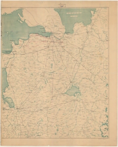
| Title | [Narva piirkond ja Venemaa] |
|---|---|
| Map type | Single sheet map |
| Reference code | ERA.T-6.3.1112 sheet 2 |
Cartographical and Publishing Description
| Main subject | administrative |
|---|---|
| Material designaton | map |
| Manuscript/Printed | printed |
| Published by | Katastri Ameti kivitrükk, 1942 |
| Created | 1942 |
Components and Mathematical Description
| Components | explication, legend for symbols, graphical scale |
|---|---|
| Azimuth | Not set |
| Relative scale | 5000000 |
Geographical Description
| Admin unit | Specification |
|---|---|
| Estonia (1917-1950) | |
| other / Europe Continent / Eastern Europe Region / Russia |
Physical Description
| Storage form | streched |
|---|---|
| Material and mounting | paper |
| Medium | printed |
| Dimensions (cm) | 90x73/A0 |
| Access-restrictions | No access restriction |