Detailed description
To view the map area,
sign in or create account
sign in or create account
22.07 58.31, 24.73 59.30
Identity Description
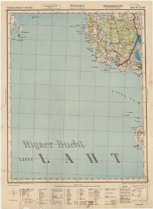
| Title | Estland-Lettland 1:100000, Haapsalu, blatt nr. 22 SO |
|---|---|
| Map type | Single sheet map |
| Reference code | ERA.T-6.3.207 sheet 1 |
Cartographical and Publishing Description
| Main subject | administrative |
|---|---|
| Material designaton | map |
| Manuscript/Printed | printed |
| Created | 1940 |
Components and Mathematical Description
| Components | explication, legend for symbols, grid lines, graphical scale |
|---|---|
| Azimuth | Not set |
| Relative scale | 1000000 |
Geographical Description
| Admin unit | Specification |
|---|---|
| Estonia (1917-1950) / Lääne County |
Physical Description
| Storage form | streched |
|---|---|
| Material and mounting | paper |
| Medium | printed+coloured |
| Dimensions (cm) | 71x51/A1 |
| Access-restrictions | No access restriction |