Detailed description
To view the map area,
sign in or create account
sign in or create account
28.17478 59.35855, 28.20705 59.39163
Identity Description
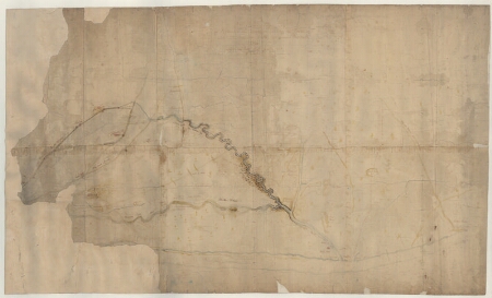
| Title | Delineatio der Ländereyen und Grenzen zwischen der Stadt Narva und dem Dorfe sonst genannt Webkulla, Item zwischen dem Dorfe Kutterkülla und Wasahoff |
|---|---|
| Map type | Single sheet map |
| Reference code | EAA.1646.1.3454 sheet 1 |
Notes
Stiliseeritud maja sümboliga Narva linnus, leppemärgiga kõrts, rehed; teedevõrk, maanteed, kirjetega sihtkohad, külatee, sillad; kirjetega heinamaade omandijaotus; vetevõrk; reljeefi olemasolu
Cartographical and Publishing Description
| Main subject | Not set |
|---|---|
| Material designaton | plan |
| Manuscript/Printed | manuscript rough draft |
| Created | 18. saj I pool |
Components and Mathematical Description
| Components | Not set |
|---|---|
| Azimuth | Not set |
| Textual scale | [1: 7900] |
| Relative scale | Not set |
Geographical Description
| Admin unit | Specification |
|---|---|
| Estonia (to 1917) / Estonia Guberniya / Viru County / Narva City/Town (to 1917) | Narva; Kudruküla, Vepsküla |
Physical Description
| Storage form | rolled |
|---|---|
| Material and mounting | paper |
| Medium | ink+coloured |
| Dimensions (cm) | 106x64/A0 |
| Access-restrictions | No access restriction |