Detailed description
To view the map area,
sign in or create account
sign in or create account
26.65 57.81, 26.80 57.95
Identity Description
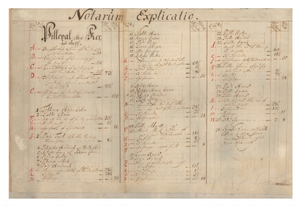
| Title | [Kirumpois Gebiet, och Pillepallhoff med des Bönder.] |
|---|---|
| Map type | Subsheet |
| Reference code | EAA.308.2.182 sheet 1p |
Belongs to main sheet
EAA.308.2.182 sheet 1
Notes
Peakaardilehe juurde kuuluv kaardikirjade seletus.
Creators
| Firstname | Lastname | Occupation of cartographer | Creators position |
|---|---|---|---|
| Lorentz | Insulander | cartographer |
Cartographical and Publishing Description
| Main subject | Not set |
|---|---|
| Material designaton | Not set |
| Manuscript/Printed | manuscript original |
| Created | 1684 |
Components and Mathematical Description
| Components | explication |
|---|---|
| Azimuth | Not set |
| Relative scale | Not set |
Geographical Description
| Admin unit | Specification |
|---|---|
| Estonia (to 1917) / Livonia Guberniya / Võru County / Urvaste Parish / Kärgula Manor | Hüüdre, Kärgula, Sulbi, Punaküla, Pulli; Sulbi veski, Võhandu jõgi |
Physical Description
| Storage form | rolled |
|---|---|
| Material and mounting | paper+textile |
| Medium | ink+coloured |
| Dimensions (cm) | 85x83/A0 |
| Access-restrictions | No access restriction |