Detailed description
To view the map area,
sign in or create account
sign in or create account
27.08679 57.64217, 27.42737 57.83861
Identity Description
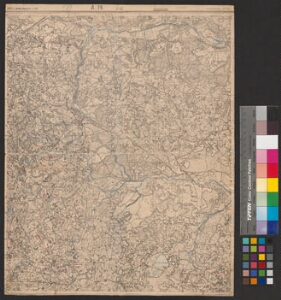
| Title | [Eesti topograafiline üheverstaline kaart] L 79, L-12 Vastseliina |
|---|---|
| Map type | Subsheet |
| Reference code | EAA.2072.5.836 sheet 376 |
Belongs to main sheet
EAA.2072.5.836 sheet 1
Cartographical and Publishing Description
| Main subject | Not set |
|---|---|
| Material designaton | map |
| Manuscript/Printed | printed |
| Published by | Sõjaväe kartograafia osakond, 1922 |
| Created | 1913 |
Components and Mathematical Description
| Components | Not set |
|---|---|
| Azimuth | Not set |
| Textual scale | 1:42000 |
| Relative scale | 42000 |
Geographical Description
| Admin unit | Specification |
|---|---|
| Estonia (to 1917) / Livonia Guberniya / Võru County | Vastseliina |
NB! location is approximate
Physical Description
| Storage form | in box |
|---|---|
| Material and mounting | paper |
| Medium | printed |
| Dimensions (cm) | 46x37/A2 |
| Access-restrictions | No access restriction |