Detailed description
To view the map area,
sign in or create account
sign in or create account
26.91 57.66, 27.17 57.77
Identity Description
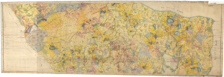
| Title | План мызных и крестянских земель казеннаго имения Гангоф Лифляндской губерний Верроскаго уезда Гангофской волости |
|---|---|
| Map type | Subsheet |
| Reference code | EAA.3724.4.1859 sheet 5 folio 2 |
Belongs to main sheet
EAA.3724.4.1859 sheet 4 folio 1
Cartographical and Publishing Description
| Main subject | Not set |
|---|---|
| Material designaton | plan |
| Manuscript/Printed | manuscript duplicate |
| Created | 1876 |
Components and Mathematical Description
| Components | compass, graphical scale |
|---|---|
| Azimuth | Not set |
| Textual scale | 1:5200 |
| Relative scale | 5200 |
Geographical Description
| Admin unit | Specification |
|---|---|
| Estonia (to 1917) / Livonia Guberniya / Võru County / Rõuge Parish / Haanja Manor | Tautsa; Nogo; Tootsi; Sika; Koke-Jüri; Koke; Vadsa; Utsali; Muna; Haapsu; Jaanimäe; Püssa; Rauba; Tilga, |
Physical Description
| Storage form | Not set |
|---|---|
| Material and mounting | paper+textile |
| Medium | ink+coloured |
| Dimensions (cm) | 73x203/A0 |
| Access-restrictions | No access restriction |