Detailed description
28.17478 59.35855, 28.20705 59.39163
Identity Description
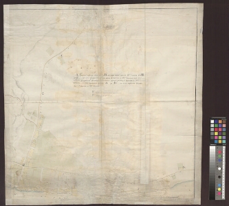
| Title | [Ситуационный план купеческой пристани и канатной фабрики въ городе Нарвы] |
|---|---|
| Map type | Single sheet map |
| Reference code | EAA.1646.1.2709 sheet 1 |
Cartographical and Publishing Description
| Main subject | town/borough |
|---|---|
| Material designaton | plan |
| Manuscript/Printed | manuscript original |
| Created | 19. saj keskpaik |
Components and Mathematical Description
| Components | explication, graphical scale |
|---|---|
| Azimuth | Not set |
| Textual scale | 130 sülda = 9,5 cm |
| Relative scale | 2900 |
Geographical Description
| Admin unit | Specification |
|---|---|
| Estonia (to 1917) / Estonia Guberniya / Viru County / Narva City/Town (to 1917) | Narva jõgi, köievabrik, Saksa-Soome kalmistu, Väikesaar, Jõesuu tänav |
Physical Description
| Storage form | streched |
|---|---|
| Material and mounting | paper |
| Medium | ink+coloured |
| Dimensions (cm) | 76x75/A0 |
| Access-restrictions | No access restriction |