Detailed description
To view the map area,
sign in or create account
sign in or create account
24.34021 57.84168, 26.88 58.86
Identity Description
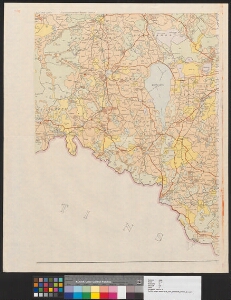
| Title | Eesti NSV skeem maakasutuste piiridega |
|---|---|
| Map type | Single sheet map |
| Reference code | ERA.T-6.5.35 sheet 1 |
Cartographical and Publishing Description
| Main subject | administrative |
|---|---|
| Material designaton | index map; outline map |
| Manuscript/Printed | printed |
| Published by | 13. IX. 1957 |
| Created | 1957 |
Components and Mathematical Description
| Components | graphical scale |
|---|---|
| Azimuth | Not set |
| Relative scale | 200000 |
Geographical Description
| Admin unit | Specification |
|---|---|
| Estonia (1950-1991) / Suure-Jaani County (1950-1959) | |
| Estonia (1950-1991) / Põltsamaa County (1950-1963) | |
| Estonia (1950-1991) / Kilingi-Nõmme County (1950-1959) | |
| Estonia (1950-1991) / Abja County (1950-1963) | |
| Estonia (1950-1991) / Elva County (1950-1962) | |
| Estonia (1950-1991) / Otepää County (1950-1959) | |
| Estonia (1950-1991) / Tõrva County (1950-1959) | |
| Estonia (1950-1991) / Viljandi County (1950-1991) |
Physical Description
| Storage form | streched |
|---|---|
| Material and mounting | paper |
| Medium | printed+coloured |
| Dimensions (cm) | 70x54/A1 |
| Access-restrictions | No access restriction |
Maps referred to by this map
| Reference code | Relation |
|---|---|
| ERA.T-6.5.35 sheet 1 | |
| ERA.T-6.5.35 sheet 2 | duplicate |
| ERA.T-6.5.35 sheet 3 | |
| ERA.T-6.5.35 sheet 4 | |
| ERA.T-6.5.35 sheet 5 | |
| ERA.T-6.5.35 sheet 6 | |
| ERA.T-6.5.35 sheet 7 | |
| ERA.T-6.5.35 sheet 8 |
Maps referring to this map
| Reference code | Manuscript/Printed |
|---|---|
| ERA.T-6.5.35 sheet 1 | printed |