Detailed description
To view the map area,
sign in or create account
sign in or create account
25.74 58.41, 26.36 58.83
Identity Description
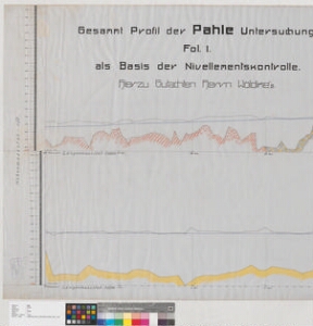
| Title | Gesammt Profil der Pahle Untersuchung Fol I als Basis der Nivellementskontrolle |
|---|---|
| Map type | Single sheet map |
| Reference code | EAA.2059.1.1683 sheet 1 |
Cartographical and Publishing Description
| Main subject | Not set |
|---|---|
| Material designaton | profile |
| Manuscript/Printed | manuscript rough draft |
| Created | 1900 (Estimated) |
Components and Mathematical Description
| Components | graphical scale |
|---|---|
| Azimuth | Not set |
| Textual scale | Längenmaasstab 1:5200 |
| Relative scale | 5200 |
Geographical Description
| Admin unit | Specification |
|---|---|
| Estonia (to 1917) / Livonia Guberniya / Viljandi County / Põltsamaa Parish | Põltsamaa jõgi |
Physical Description
| Storage form | rolled |
|---|---|
| Material and mounting | tracing cloth |
| Medium | ink+coloured |
| Dimensions (cm) | 77x1280/>4A0 |
| Access-restrictions | No access restriction |