Detailed description
20.96 55.67, 28.41 59.69
Identity Description
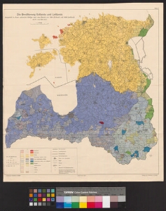
| Title | Die Bevölkerung Estlands und Lettlands dargestellt in ihrem Gefüge nach dem Stande von 1934 (Estland) und 1935 (Lettland) |
|---|---|
| Map type | Multiple-sheet map |
| Reference code | EAA.5392.1.258 sheet 1 |
Subsheets
| Reference code |
|---|
| EAA.5392.1.258 sheet 1p |
Creators
| Firstname | Lastname | Occupation of cartographer | Creators position |
|---|---|---|---|
| K. von | Maydell | cartographer |
Cartographical and Publishing Description
| Main subject | demographic |
|---|---|
| Material designaton | plan |
| Manuscript/Printed | printed |
| Published by | Leopold Kraatz, Berlin |
| Created | 1940 |
Components and Mathematical Description
| Components | legend for symbols, graphical scale |
|---|---|
| Azimuth | Not set |
| Relative scale | 1000000 |
Geographical Description
| Admin unit | Specification |
|---|---|
| other / Europe Continent / Northern Europe Region / Latvia | |
| Estonia (1917-1950) |
Physical Description
| Storage form | streched |
|---|---|
| Material and mounting | paper |
| Medium | printed+coloured |
| Dimensions (cm) | 52x47/A1 |
| Access-restrictions | No access restriction |
Documents of description
| Reference code | Title | Creator | Year |
|---|---|---|---|
| EAA.5329.1.258 sheet 1p | [Kohanimede register] |
