Detailed description
To view the map area,
sign in or create account
sign in or create account
25.38 58.79, 26.02 59.27
Identity Description
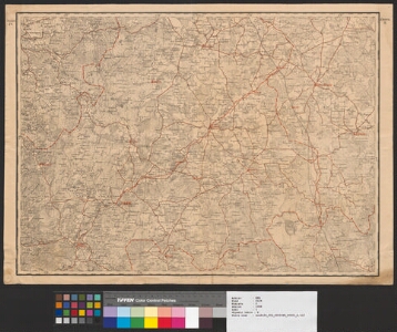
| Title | Рядъ IV. Листь 5 [Vabadussõja kaart] |
|---|---|
| Map type | Single sheet map |
| Reference code | ERA.2124.2.1088 sheet 1 |
Cartographical and Publishing Description
| Main subject | military |
|---|---|
| Material designaton | map |
| Manuscript/Printed | printed |
| Created | 1918 (Estimated) |
Components and Mathematical Description
| Components | Not set |
|---|---|
| Azimuth | Not set |
| Relative scale | 126000 |
Geographical Description
| Admin unit | Specification |
|---|---|
| Estonia (1917-1950) / Järva County / Ambla Commune (1917-1950) | |
| Estonia (1917-1950) / Järva County / Türi Commune (1917-1938) | |
| Estonia (1917-1950) / Järva County / Paide Commune (1938-1950) |
Physical Description
| Storage form | streched |
|---|---|
| Material and mounting | paper |
| Medium | printed+coloured |
| Dimensions (cm) | 48x65/A1 |
| Access-restrictions | No access restriction |
Maps referred to by this map